Identity area
Reference code
Title
Date(s)
- 1839 (Creation)
Level of description
Collection
Extent and medium
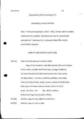
2 maps, one framed +35mm slide Size : 80cm X 130cm
Context area
Name of creator
Biographical history
Appointed first assistant surveyor of Van Diemen's Land in 1826. For more information see http://adb.anu.edu.au/biography/frankland-george-2064
Immediate source of acquisition or transfer
Deposited by Mrs Dumaresq in 1973. Note : The Dumaresq Papers, 1815 - 1922, remain with the family at Mount lreh, Longford, Tasmania and may be consulted by arrangement. Summary list in S&R correspondence file may be consulted on request.
Content and structure area
Scope and content
Collection consists of one framed and one folded in book form Map of Van Diemen's Land by George Frankland, dated 1839. Dedicated to the Land Holders of the Colony by their faithful servant, George Frankland, Surveyor General and Sole Commissioner of Crown Lands . The map shows : counties, hundreds, parishes, townships, reserves for townships, roads, houses, names of landholders. Inset plans of Hobart and Launceston (24cm X 21cm) Scale : 20 miles : 7cm Size : 80cm X 130cm
Appraisal, destruction and scheduling
Accruals
System of arrangement
Conditions of access and use area
Conditions governing access
Conditions governing reproduction
This material is made available for personal research and study purposes under the University of Tasmania Standard Copyright Licence. For any further use permission should be obtained from the copyright owners. For assistance please contact Special.Collections@utas.edu.au
When reusing this material, please cite the reference number and provide the following acknowledgement:
“Courtesy of the UTAS Library Special & Rare Collections”
Language of material
Script of material
Language and script notes
Physical characteristics and technical requirements
Finding aids
Existence and location of originals
Existence and location of copies
Related units of description
Alternative identifier(s)
Access points
Subject access points
Place access points
Name access points
Genre access points
Description identifier
Institution identifier
Rules and/or conventions used
Status
Level of detail
Dates of creation revision deletion
HE Oct2019
Language(s)
Script(s)
Sources
Digital object metadata
Latitude
Longitude
Media type
Text
Mime-type
application/pdf


